What county is Marble Falls in?
Marble Falls is in Burnet County in the northern-central Texas Hill Country.
Burnet County · Colorado River · Highland Lakes
Marble Falls is in southern Burnet County on the Colorado River, about 13 miles southeast of Burnet. Today the city sits on Lake Marble Falls, part of the Highland Lakes chain—but the town was named for natural river falls that now lie beneath the lake.
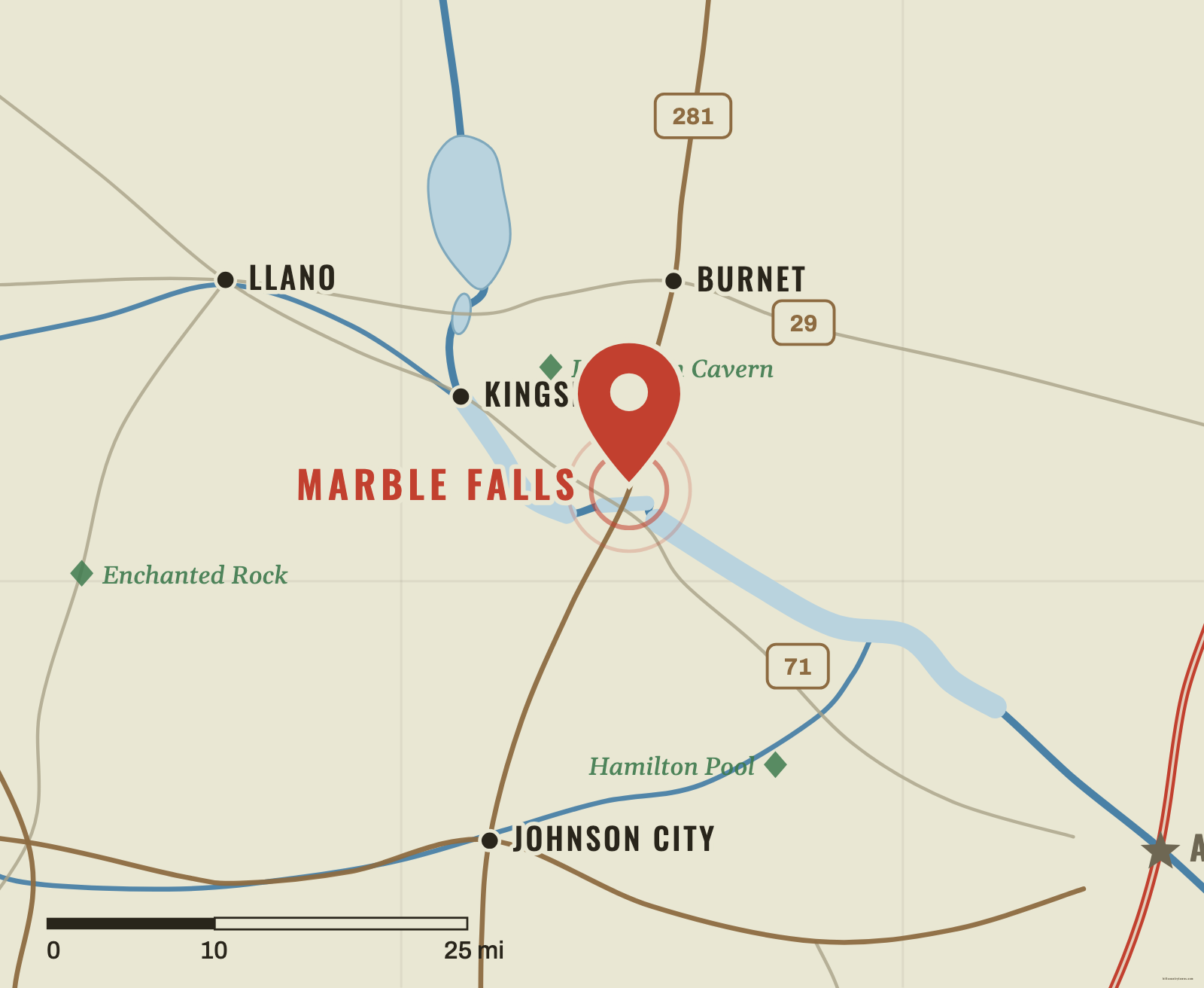
Marble Falls sits in the northeastern-central Hill Country, where U.S. 281 crosses the Colorado River. Burnet is north and slightly west. Llano lies farther west. Kingsland and the upper Highland Lakes sit upstream. If you can find the Colorado River and the Highland Lakes chain, Marble Falls becomes much easier to place.
Unlike Kerrville or Wimberley, where a free-flowing river is the obvious landmark, Marble Falls is now identified with a narrow lake. Lake Marble Falls follows the old Colorado River channel through steep Hill Country terrain.
The name is a geographic fossil. Long before the city existed, travelers used the natural falls on the Colorado River as a landmark and referred to them as the Great Falls or Marble Falls. Adam Rankin Johnson saw the site in the 1850s and imagined a town that could use the river’s power, but the durable settlement was not laid out until the 1880s.
Town lots went on sale in 1887. The Colorado River remained central to the city’s identity, but the feature that gave Marble Falls its name eventually disappeared from view. Max Starcke Dam was built in the early 1950s, creating Lake Marble Falls and covering the old natural falls.
Marble Falls also belongs to the Central Mineral Region, where granite and much older rocks break the visual pattern of the surrounding limestone Hill Country. Granite Mountain, just west of the city, became part of one of the most recognizable building projects in Texas.
The City of Marble Falls records that Granite Mountain supplied granite for the Texas State Capitol. Between 1885 and 1887, roughly 15,700 loads were transported toward Austin. The railroad connection created for the granite industry also helped open the area to wider development.
Marble Falls is an anchor for the northern-central part of Hill Country Wayfinder. It helps connect Burnet and Llano to the east–west Highland Lakes corridor and gives you a bridge between the more granite-influenced northern terrain and the classic limestone Hill Country farther south, down toward Johnson City.
A landmark that changed form
Schematic · not to scale
The sequence to remember: natural falls on the Colorado gave the town its name, Max Starcke Dam impounded the river in the early 1950s, and Lake Marble Falls now covers the falls themselves.
A second map connection
Schematic · not to scale
The pink granite in the Texas State Capitol came from Granite Mountain beside Marble Falls, hauled toward Austin by rail in the late 1880s. The rail line built for the granite trade helped open this corner of the Hill Country.
Find the Highland Lakes
Find the Colorado River west of Austin, then look south of Burnet along U.S. 281.
Tap or click the map to drop your pin.
The Highland Lakes cluster, from the game’s coordinate data.
Approx. straight-line distances, measured from the game's coordinates — not driving distances.
Marble Falls is in Burnet County in the northern-central Texas Hill Country.
Marble Falls is on the Colorado River. Today the river is impounded here as Lake Marble Falls.
No. The natural falls that gave the city its name were submerged when Max Starcke Dam created Lake Marble Falls in the early 1950s.
Marble Falls is about 13 miles southeast of Burnet, on the Colorado River and U.S. 281.