What county is Llano in?
Llano is the county seat of Llano County.
Llano County · Llano River · Central Mineral Region
Llano is the county seat of Llano County on both sides of the Llano River, about 75 miles northwest of Austin. On the Hill Country map it sits north of Fredericksburg, west of Burnet and Marble Falls, and near the heart of the geologically unusual Llano Uplift.
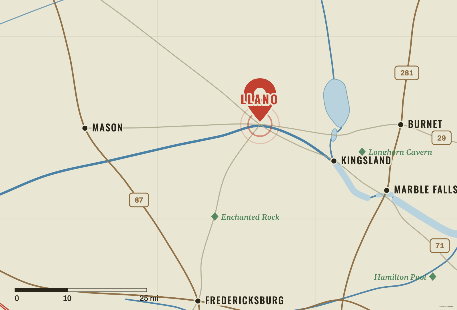
Llano sits in the northern-central Hill Country on the river that shares its name. If Fredericksburg is your anchor, move north and slightly east. If Marble Falls is your anchor, move west and north. Mason lies farther west. Burnet lies east.
The Llano River is the strongest clue. The original townsite was deliberately surveyed on both sides of the river, so unlike towns that merely happen to sit near a waterway, Llano was built around the river crossing from the start.
Llano exists where it does because the creation of Llano County required a county seat. In 1856, competing locations were considered, and voters selected the Llano River site. Donated land provided a roughly 250-acre townsite that was surveyed on both sides of the river near the center of the new county.
The early community was a frontier trading center serving ranchers and farmers. The courthouse square and river crossing gave it a durable civic role even before later industries arrived.
In the late 1880s, discoveries and speculation about local iron and other minerals produced an extraordinary boom. Investors promoted furnaces, foundries, railroads, power projects and new development north of the river. Streets received industrial names, and boosters imagined Llano becoming a “Pittsburgh of the West.”
The grandest plans did not survive. The expected iron resources were not commercially productive on the scale promoters hoped for, and the boom faded. Granite, however, remained an important industry. That story is useful because it connects the town’s human history to the geology under it.
Llano sits in the broader Central Mineral Region associated with the Llano Uplift. This is one of the strangest pieces of Hill Country geology: erosion exposes very old Precambrian crystalline rocks inside terrain otherwise surrounded by younger sedimentary rocks. Texas Parks and Wildlife notes that the Llano Uplift contains some of the oldest rocks exposed in Texas.
That is why the northern-central Hill Country can look different from the classic limestone canyon country around Kerrville or Wimberley. Granite domes, mineral-bearing rocks and the Llano River belong to a different geological story—even though Texans still experience the whole area as part of the Hill Country.
The map under the map
Schematic · not to scale
Think of the Llano Uplift as a window: erosion has worn through the younger limestone layers and exposed far older crystalline rock beneath. Llano, Enchanted Rock and the granite country all sit inside that window.
Find the river
Start north of Fredericksburg and west of Burnet. The Llano River is your strongest clue.
Tap or click the map to drop your pin.
The northern cluster, from the game’s coordinate data.
Approx. straight-line distances, measured from the game's coordinates — not driving distances.
Llano is the county seat of Llano County.
The Llano River runs through the city, and the original townsite was surveyed on both sides of the river.
Yes. Llano is in the northern-central Hill Country, within the geologically distinctive Central Mineral Region / Llano Uplift.
The Llano Uplift is a Central Texas geologic region where erosion exposes very old crystalline rocks surrounded by younger rock layers. It helps explain the granite and mineral-rich landscapes around Llano and Burnet counties.