The labeled map
Texas Hill Country Map With Towns
The Texas Hill Country is easier to learn when the towns stop looking like isolated dots. This map labels all 36 communities used in Hill Country Wayfinder—from familiar anchors like Fredericksburg, Kerrville and New Braunfels to smaller places such as Hye, Sisterdale, Vanderpool and Luckenbach.
Open the full-resolution map, download a copy, or switch back to the unlabeled game and see how many towns you can place from memory.
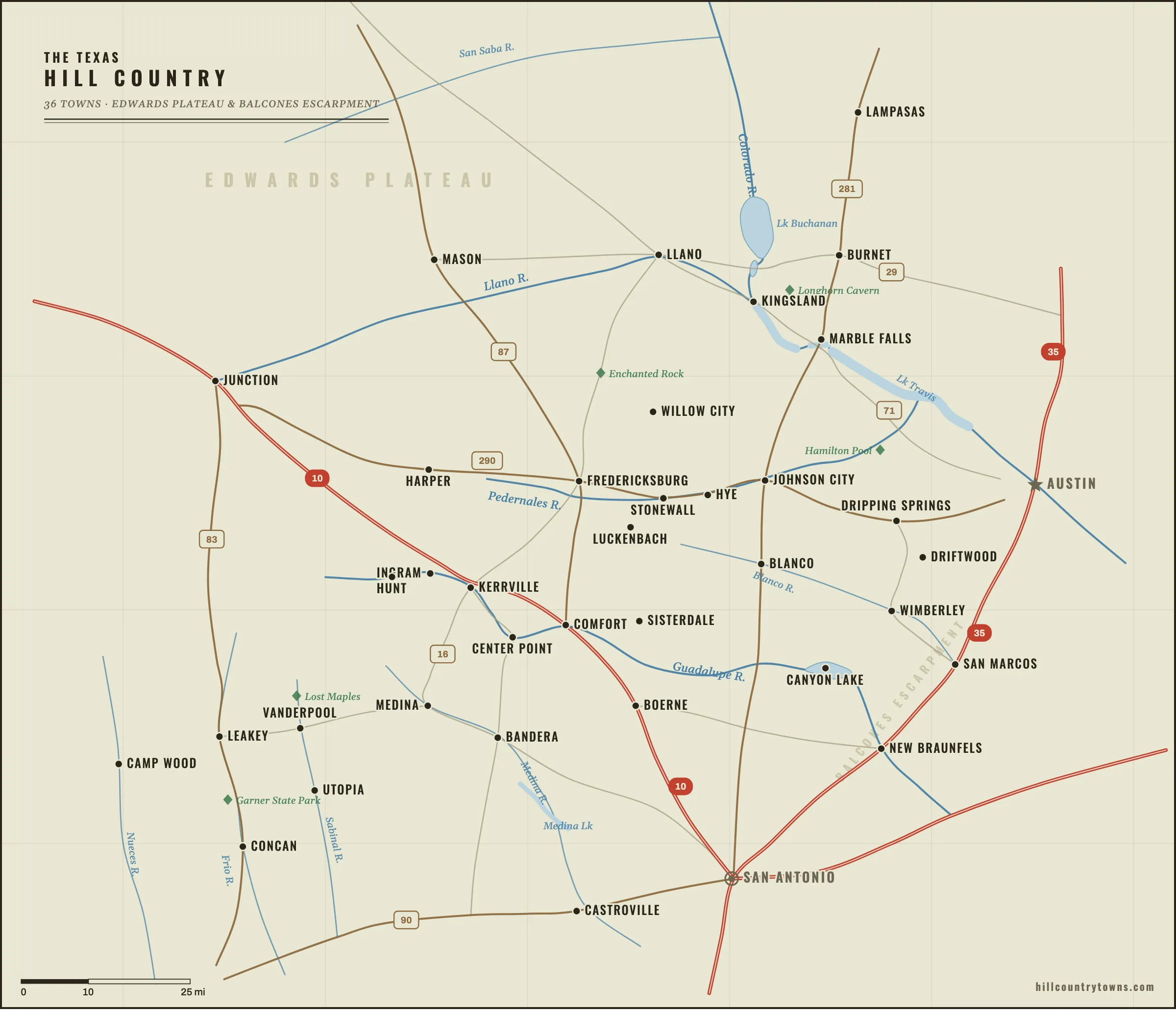
Download the map
Need a labeled version instead of the game? Download the full-resolution map for reference, teaching, editorial use, or trip planning.
- WebP2400 × 2059 · smallest file · 171 KBDownload →
- PNG2400 × 2059 · widest compatibility · 866 KBDownload →
- PDFvector · prints clean at any size · 233 KBDownload →
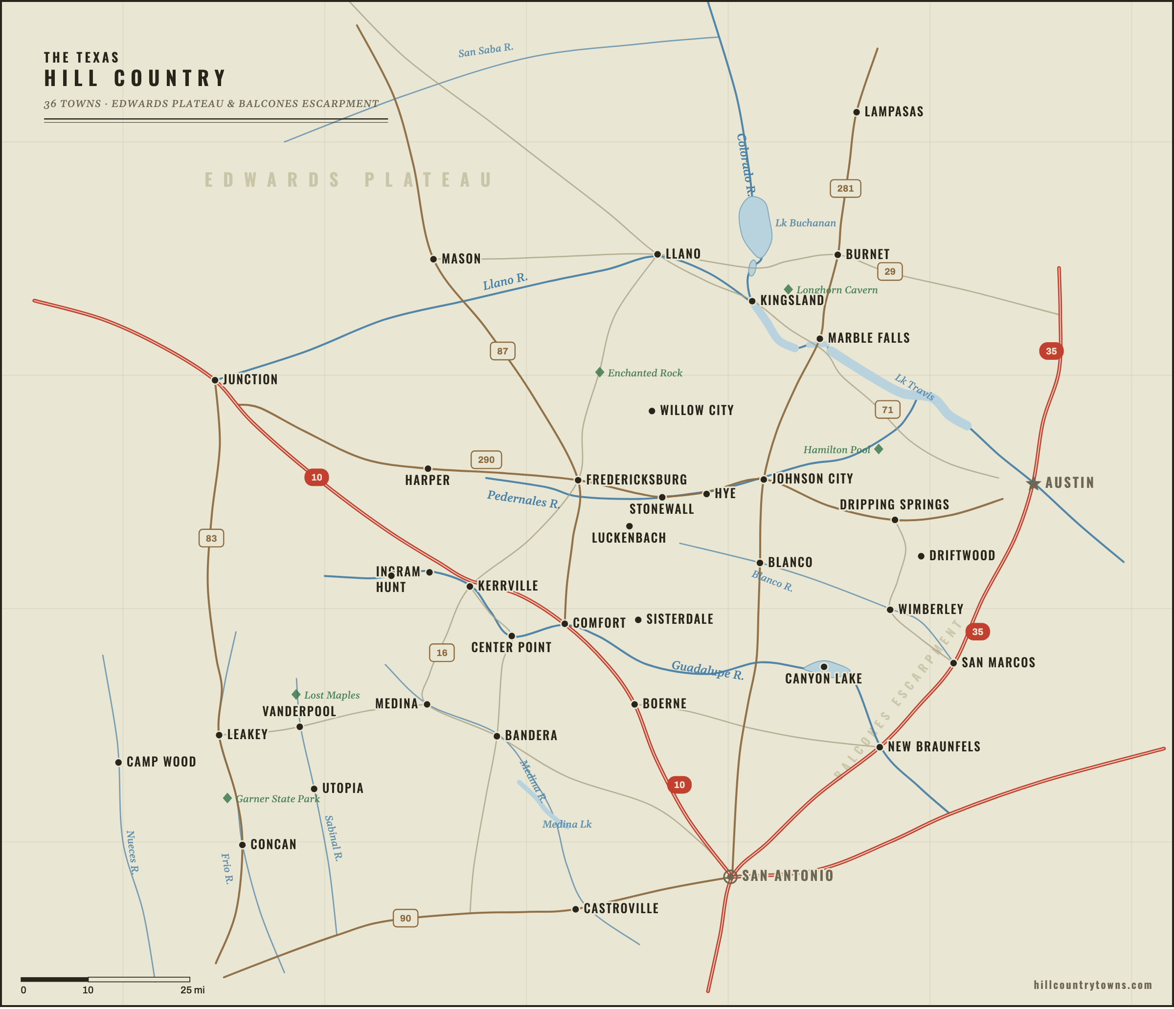
Want to use the map on your own site or in a classroom? You may share the labeled map for editorial or educational use with attribution and a link to HillCountryTowns.com.
Learn it, don’t just look at it
The labeled map is the answer key. The better way to memorize the region is the unlabeled game — drop pins from memory and let the miles tell you how close you are. When a town keeps escaping you, its guide is the fix. All 36 towns now have a close-up map, the geography that explains the location, and a one-town pin challenge:
Bandera · Blanco · Boerne · Burnet · Camp Wood · Canyon Lake · Castroville · Center Point · Comfort · Concan · Driftwood · Dripping Springs · Fredericksburg · Harper · Hunt · Hye · Ingram · Johnson City · Junction · Kerrville · Kingsland · Lampasas · Leakey · Llano · Luckenbach · Marble Falls · Mason · Medina · New Braunfels · San Marcos · Sisterdale · Stonewall · Utopia · Vanderpool · Willow City · Wimberley
Not sure what the Hill Country even includes? Start with Where is the Texas Hill Country? or read how the map is built. Or add pasture monsters, fake towns and giant fiberglass people to the map with the weirdest roadside attractions in the Texas Hill Country.