What county is Boerne in?
Boerne is the county seat of Kendall County.
Kendall County · Cibolo Creek · Southern Hill Country
Boerne is the county seat of Kendall County, about 30 miles northwest of San Antonio. It sits on Cibolo Creek along Interstate 10, making it one of the clearest gateway towns between the San Antonio side of the state and the interior Texas Hill Country.
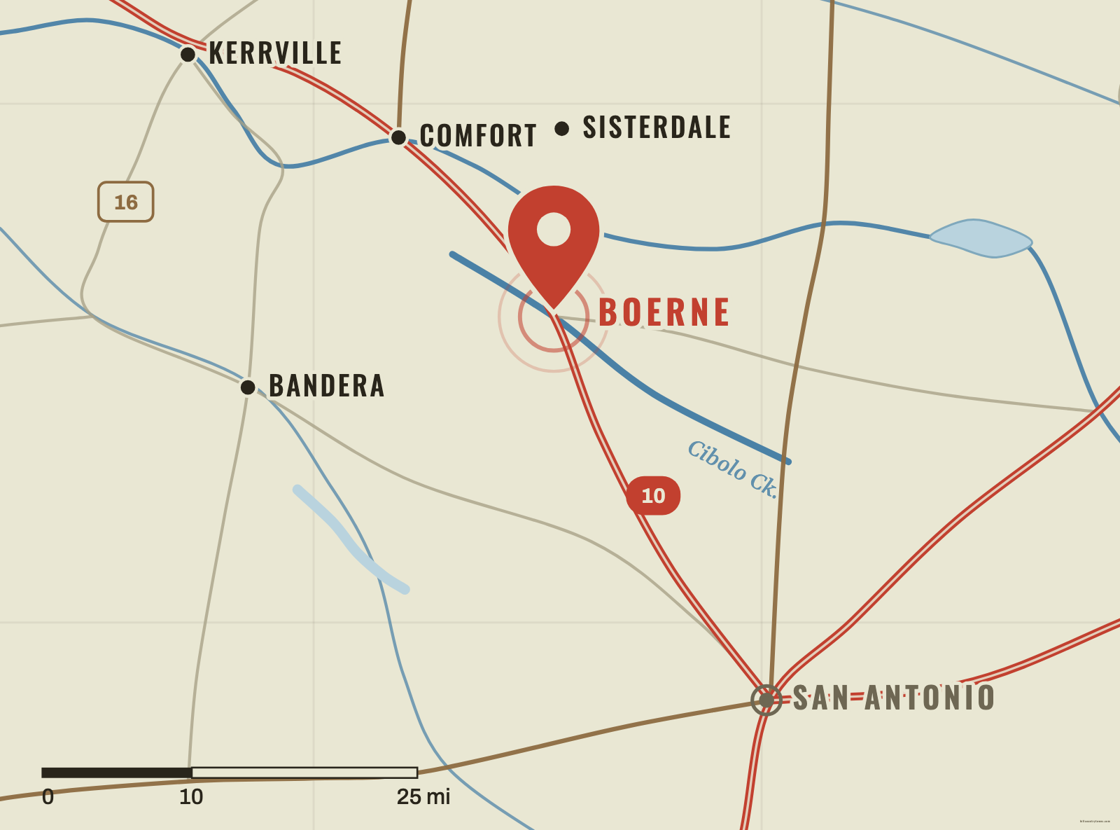
Boerne sits near the southern edge of the Hill Country, close enough to San Antonio to work as a gateway but far enough into Kendall County that the terrain, creeks and historic settlement pattern read unmistakably as Hill Country. On an unlabeled map, start northwest of San Antonio along the I-10 corridor. Comfort lies farther northwest; Bandera is to the west; Sisterdale is north of Boerne in the interior of Kendall County.
The highway is the modern clue. The older clue is Cibolo Creek. Boerne developed directly along the creek, and official city planning material describes the Cibolo as a thread tying together the town’s natural and cultural history. If you remember Boerne as a creek town before you remember it as a suburb or highway exit, its map position makes more sense.
Long before modern commuters used I-10, water made this location useful. Cibolo Creek gave early settlers a dependable natural corridor through the southern Hill Country. German immigrants established communities across this part of Central Texas in the middle of the nineteenth century, and the Boerne townsite was laid out in 1852 by John James and Gustav Theissen.
The town was named for Karl Ludwig Börne, a German writer and publicist who never lived in Texas. The spelling still advertises that German connection, even though the local pronunciation is simpler: the City of Boerne says it is pronounced “Bernie.”
Boerne grew slowly at first. A post office appeared in 1856, and the community became the seat of newly created Kendall County in 1862. During the nineteenth century the town developed a reputation as a health retreat, drawing visitors who associated the higher Hill Country setting with cooler air and restorative surroundings.
The arrival of the San Antonio and Aransas Pass Railway in 1887 tightened Boerne’s connection to San Antonio. Interstate 10 later reinforced the same geographic relationship on a much larger scale. That is the useful map lesson: Boerne has long been a point where the Hill Country meets the routes coming northwest out of San Antonio.
Boerne helps organize the southern third of the map. Learn it, and Comfort becomes an easy move up and left; Bandera becomes a move west; Sisterdale sits north into the ranch country. Boerne is less useful as an isolated dot than as a hinge between San Antonio, Cibolo Creek and the interior Hill Country — with Kerrville waiting farther up the I-10 corridor.
One town, two map clues
Schematic · not to scale
Two lines explain Boerne: Cibolo Creek, the settlement-era corridor the town grew along, and Interstate 10, the modern one running down to San Antonio. Boerne sits where they meet.
Gateway test
Start northwest of San Antonio and look for the southern Hill Country corridor toward Comfort.
Tap or click the map to drop your pin.
The southern gateway cluster, from the game’s coordinate data.
Approx. straight-line distances, measured from the game's coordinates — not driving distances.
Boerne is the county seat of Kendall County.
Yes. Boerne is a southern Hill Country town on Cibolo Creek, northwest of San Antonio.
The local pronunciation is “Bernie.” The town was named for German writer Karl Ludwig Börne.
Boerne is about 30 miles northwest of San Antonio and is connected to the city by the I-10 corridor.